


Ozark Voting District, Texas County, Missouri
About
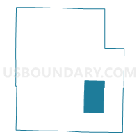
Outline

Summary
| Unique Area Identifier | 611489 |
| Name | Ozark Voting District |
| County | Texas County |
| State | Missouri |
| Area (square miles) | 58.67 |
| Land Area (square miles) | 58.67 |
| Water Area (square miles) | 0.00 |
| % of Land Area | 100.00 |
| % of Water Area | 0.00 |
| Latitude of the Internal Point | 37.20929760 |
| Longtitude of the Internal Point | -91.80794650 |
Maps


Graphs
Select a template below for downloading or customizing gragh for Ozark Voting District, Texas County, Missouri


Neighbors
Neighoring Voting District (by Name) Neighboring Voting District on the Map
- Carroll Voting District, Texas County, MO
- Cass No. 1 Voting District, Texas County, MO
- Cass No. 2 Voting District, Texas County, MO
- Current Voting District, Texas County, MO
- Date Voting District, Texas County, MO
- Jackson Voting District, Texas County, MO
- Pierce Voting District, Texas County, MO
- Piney Voting District, Texas County, MO
Top 10 Neighboring County Subdivision (by Population) Neighboring County Subdivision on the Map
- Piney township, Texas County, MO (4,770)
- Cass township, Texas County, MO (1,268)
- Jackson township, Texas County, MO (1,233)
- Carroll township, Texas County, MO (1,056)
- Ozark township, Texas County, MO (476)
- Date township, Texas County, MO (474)
- Pierce township, Texas County, MO (463)
- Current township, Texas County, MO (294)
Top 10 Neighboring Elementary School District (by Population) Neighboring Elementary School District on the Map
Top 10 Neighboring Unified School District (by Population) Neighboring Unified School District on the Map
- Houston R-I School District, MO (5,908)
- Cabool School District, MO (5,620)
- Summersville R-II School District, MO (3,058)
Top 10 Neighboring State Legislative District Lower Chamber (by Population) Neighboring State Legislative District Lower Chamber on the Map
Top 10 Neighboring State Legislative District Upper Chamber (by Population) Neighboring State Legislative District Upper Chamber on the Map
Top 10 Neighboring 111th Congressional District (by Population) Neighboring 111th Congressional District on the Map
Top 10 Neighboring Census Tract (by Population) Neighboring Census Tract on the Map
Top 10 Neighboring 5-Digit ZIP Code Tabulation Area (by Population) Neighboring 5-Digit ZIP Code Tabulation Area on the Map
- 65793, MO (6,337)
- 65483, MO (4,737)
- 65571, MO (2,134)
- 65555, MO (1,087)
- 65464, MO (492)
- 65589, MO (188)
- 65468, MO (102)